Frequently Asked Questions
What is the FEM Report?
The FEM is a purpose-built flood evacuation model for the Hawkesbury-Nepean Valley that the NSW Government has developed in partnership with industry experts. It provides a detailed understanding of the evacuation road capacity during floods, helping to inform integrated regional land use, road evacuation and emergency planning.
Why have the flood levels changed to 27.6m above sea level (1:100 to PMF)?
The Flood Evacuation Modelling report has not changed the flood level. Evacuation modelling was undertaken for a range of floods levels so emergency services such as the SES can plan for the different flood events that could occur in the Hawkesbury-Nepean Valley.
What does this mean for insurance?
There is no correlation between this report which looks at how people can evacuate safely during a flood and the cost of flood insurance premiums. The modelling is based on the current flood risks in the area. Insurance is based on the risk of property damage not evacuation routes.
How can you say there is a risk to life when the water only comes up to the ankles?
‘Risk to life’ is defined as people unable to evacuate by road due to either being trapped by floodwaters or being on the evacuation road network for more than 12 hours. Recognising these are exceptional circumstances and taking a conservative approach, 12 hours has been selected by the NSW Government as the limit of people’s tolerance to access without food and water, as well as a time when cars would run out of fuel.
What does this mean for interest rates?
There is no correlation between this decision and interest rates.
Will this affect land rezoning?
All rezoning on the Hawkesbury Nepean Flood plain will be evaluated under the same process using recommendations from the 2022 Flood Inquiry and the Flood Evacuation Modelling.
What about Marsden Park North and Schofields West?
Whilst Marsden Park North and Schofields West are no longer part of my electorate, the finalisation reports are public record and state the capacity of the evacuation road network to enable evacuation of the precinct is a major barrier to potential development.
Why is the Government stopping all development in the town centre?
The Town Centre Masterplan was developed in 2016 by Blacktown City Council. The plan included over 3800-units, housing approximately 10,000 people. Adding 10,000 people to the evacuation model will increase the risk to life. Without an upgrade to the road infrastructure, the proposed Town Centre cannot proceed. The Master Plan proposed by Blacktown City Council is six years old; rather than trying to reimagine the plan, it has been decided to redesign it. The 2016 Masterplan has been denied by the State Government on four separate occasions over the last six years due to issues with both flooding and traffic.
How does this fit with the Government's housing targets?
This area has taken on more than its fair share of housing especially over the last five years, what was once paddocks has now become unit towers and the infrastructure to support the new population has not been delivered. Many other areas throughout Sydney have sufficient infrastructure to absorb some of the load while we concentrate on backfilling the needed infrastructure.
Will all NSW Councils have to adopt the flood plan of high-medium and low risk flooding being at the PMF levels?
The results of the Flood Evacuation Model (FEM) and decisions regarding Marsden Park North, West Schofields and Riverstone Town Centre do not change current Hawkesbury – Nepean Valley flood levels. Current flood levels are identified in Hawkesbury-Nepean Valley Regional Flood Study, 2019 https://flooddata.ses.nsw.gov.au/flood-projects/hawkesbury-nepean-valley-regional-flood-study. Council’s adoption of any future change to these flood levels is a matter for them.
If so, will low risk PMF levels be appearing on the section 10.7 zoning certificates which must be provided for the sale of real estate?
As per the response above, the FEM and the planning decisions for Marsden Park North, West Schofields and the Riverstone Town Centre do not change the adopted flood levels, and therefore will not change the flood information on the Section 10.7 planning certificates.
Is it possible that properties above the existing building height (generally 17.3m contour) should not be required to be noted as flooding on the Section 1.7 certificate?
See previous response.
If you own a vacant block of land that meets the 17.3m building level, will they be able to build?
The current land use zones and planning controls under Blacktown’s 2015 Local Environmental Plan will continue to apply. The discontinuation of the rezoning will not change the existing land use in these areas or the types of development that are currently permitted under the local council’s planning controls.
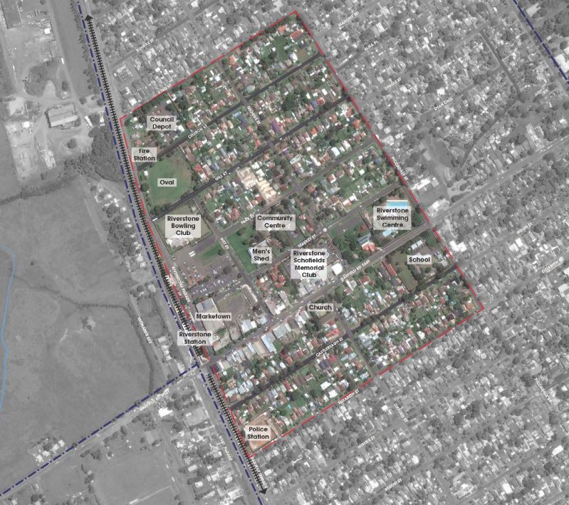
Is the Riverstone Town Centre in a high-risk flood plain?
The Riverstone Town Centre is affected by flooding from the Hawkesbury – Nepean. The planning decision for Riverstone Town Centre was based on the evacuation capacity constraints in the wider road network, in the event of flooding. The department will conduct additional work to identify what residential development may be possible and how the Reconstruction Authority NSW, Blacktown City Council and the department can work together to realise Council’s master plan and vision for this centre.